Drone Services
aerial photography and video
Showcase your property, lodge, business, or destination with stunning aerial imagery and cinematic drone footage.
Tourism & hospitality marketing
Lodge and safari content
Real estate photography
Event coverage
Promotional videos
surveying and mapping
Accurate aerial data collection for planning, development, and land management.
Orthomosaic mapping
Site documentation
Progress monitoring
Land-use planning
construction and infrastructure
Improve safety, reduce costs, and monitor progress with aerial inspections.
Construction progress reports
Roof inspections
Infrastructure inspections
Remote site assessments
Asset documentation
Conservation & Environmental
Supporting Namibia’s conservation and research efforts through aerial data collection.
Wildlife monitoring
Conservation mapping
Environmental documentation
Research support
Protected area surveys
Agriculture
Modern aerial data solutions for agricultural operations across Namibia.
Our drone services provide accurate, high-resolution insights that help farmers and agricultural businesses monitor land, water resources, and crop performance more efficiently.
Property and field mapping
Crop monitoring and documentation
Irrigation and water management surveys
Dam and reservoir inspections
Aerial progress reporting
High-resolution imagery and analysis
farm services
Practical aerial support for day-to-day farm management.
Reduce time spent in the field and gain a complete overview of your property with fast, efficient drone inspections and monitoring.
Fence line inspections
Livestock monitoring and location
Water point inspections
Infrastructure surveys
Road and access track assessments
Farm documentation and reporting
Namibia from above.
Whether you need stunning visuals for marketing, accurate aerial data for planning, or inspections in difficult-to-access locations, Desert Drones Namibia delivers a new perspective.
Contact us today to discuss your project.
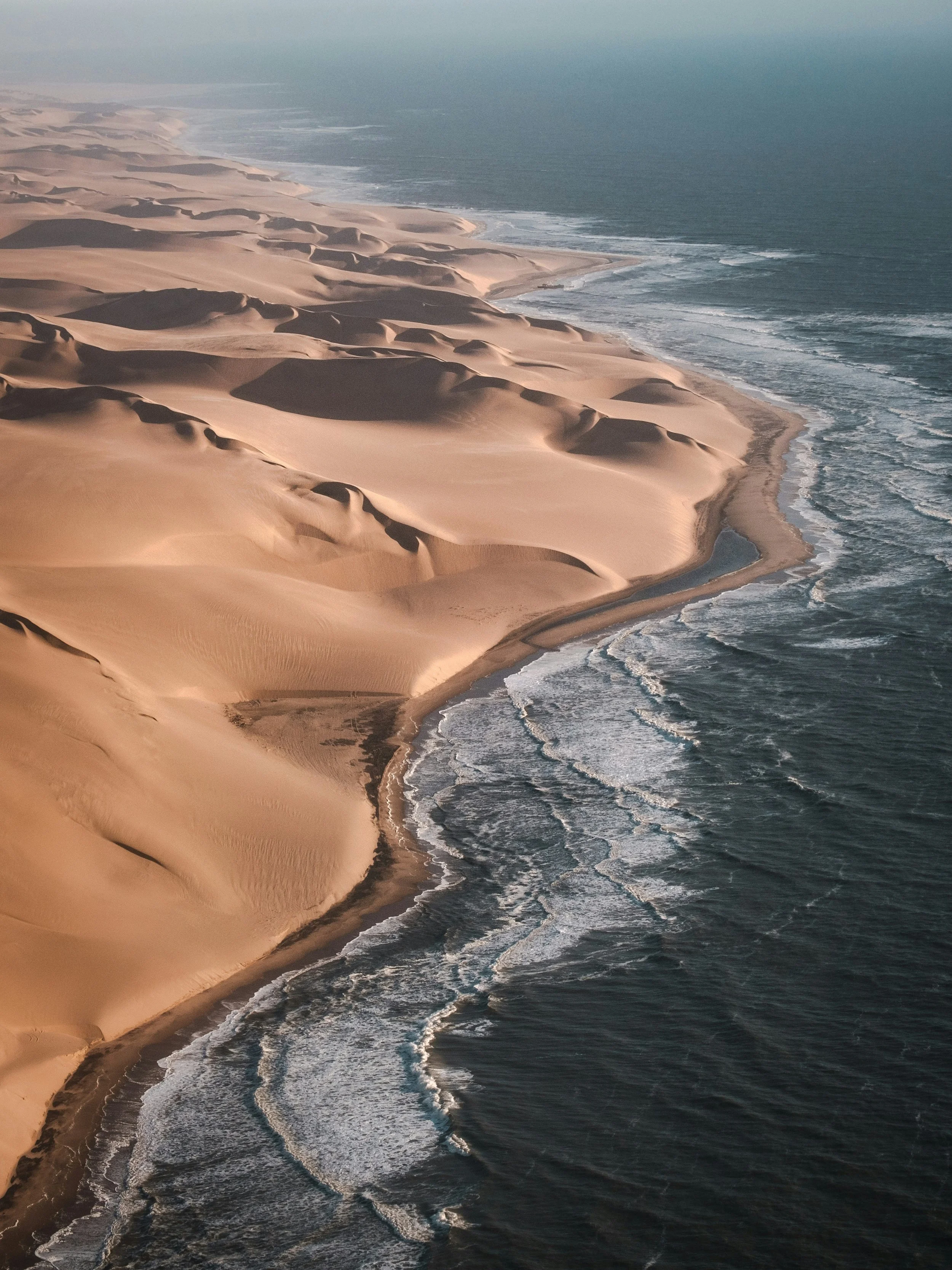
Desert Drones | Previous Projects in Namibia
-
![A modern house with a backyard featuring some patio chairs, a swimming pool, trees, and mountainous hills in the background during daylight.]()
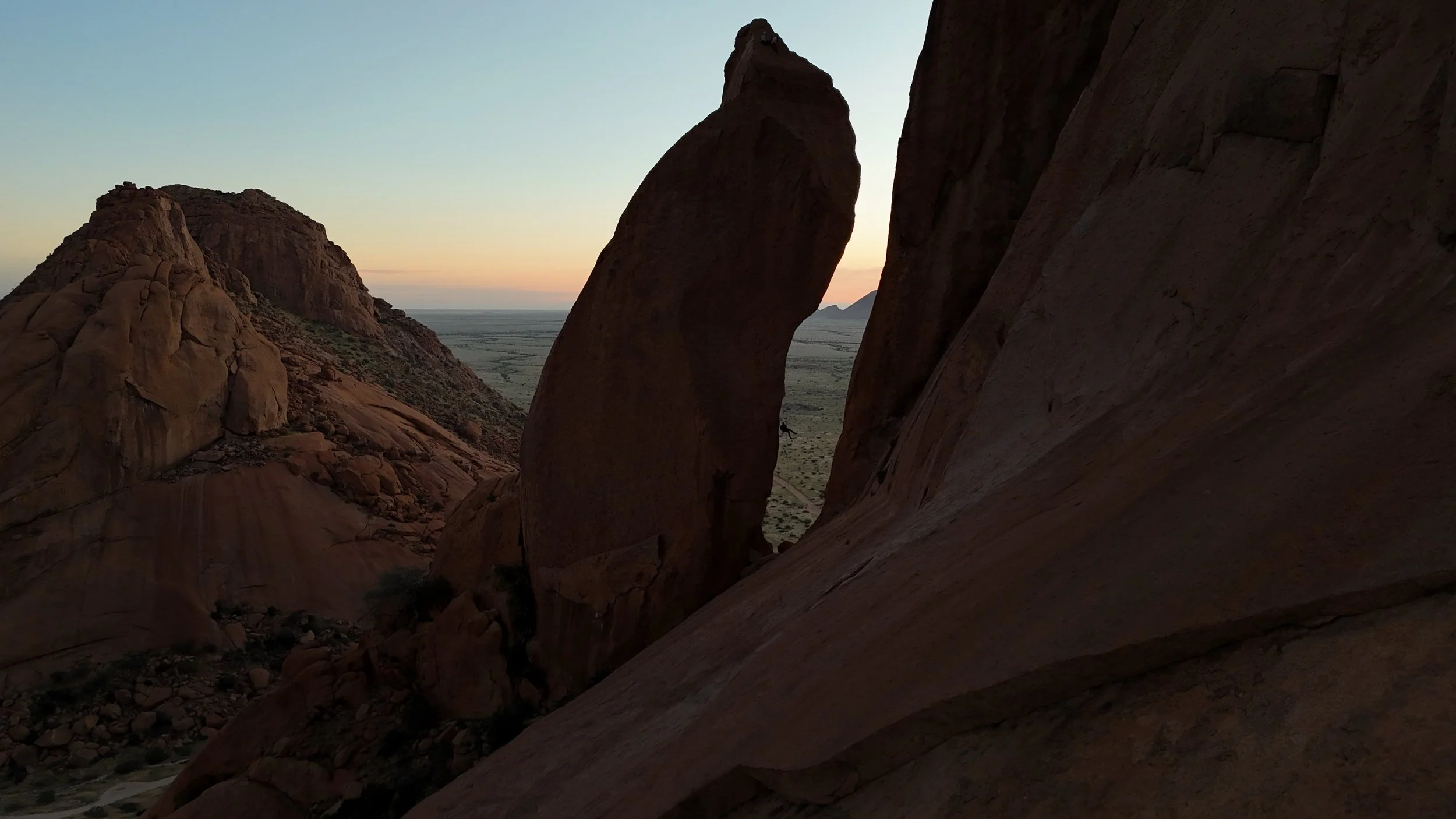
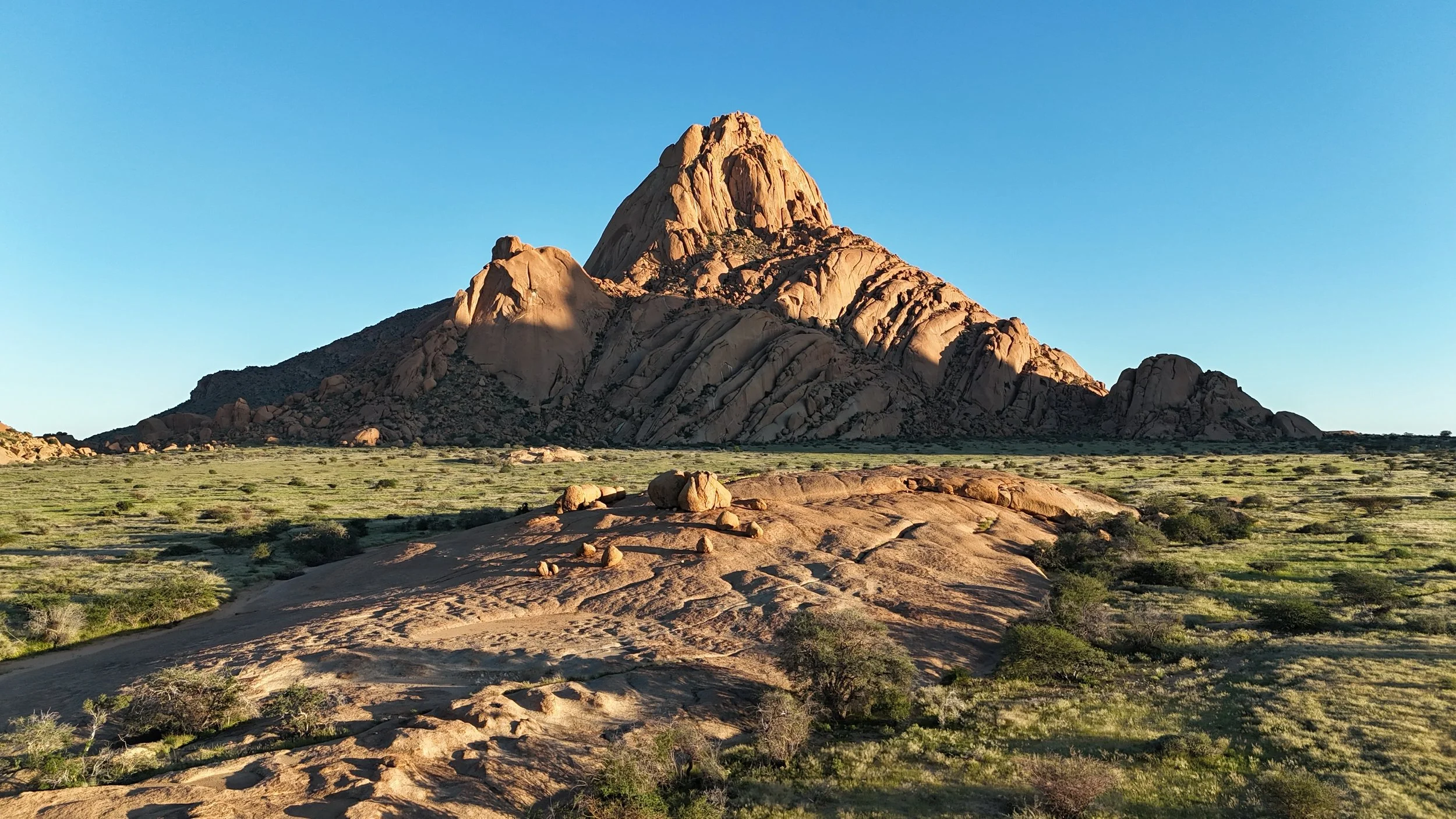
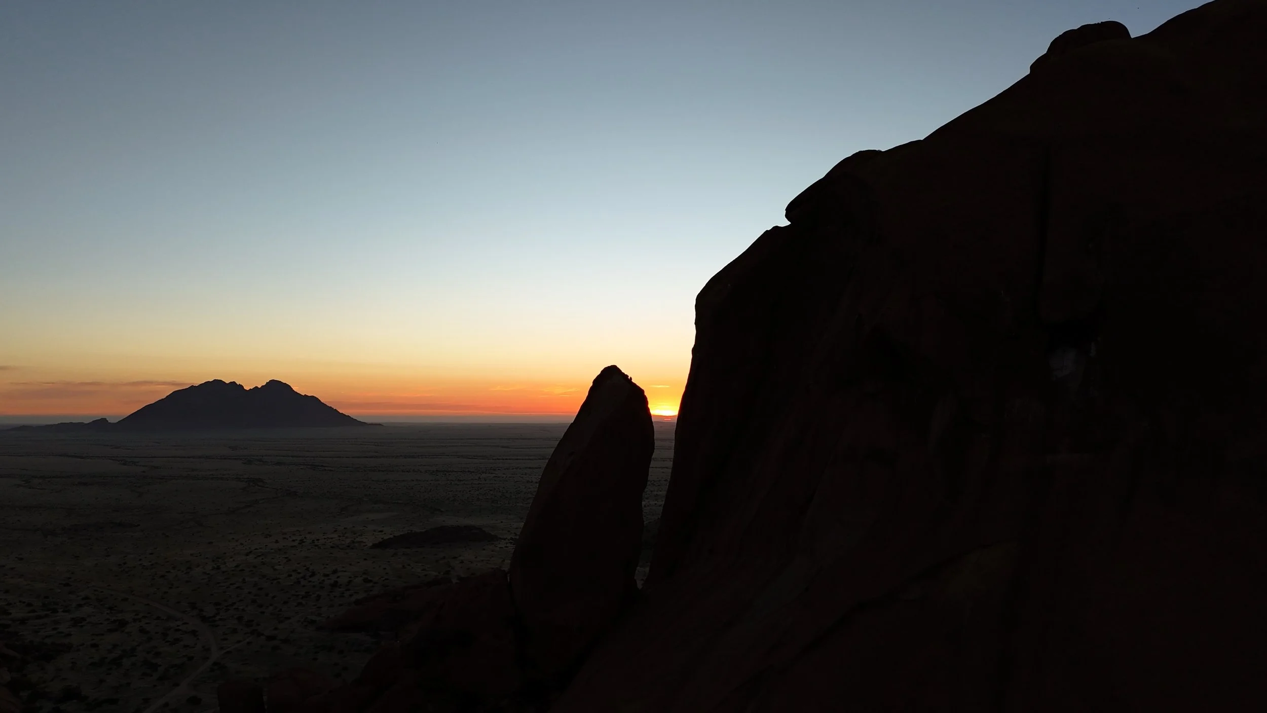
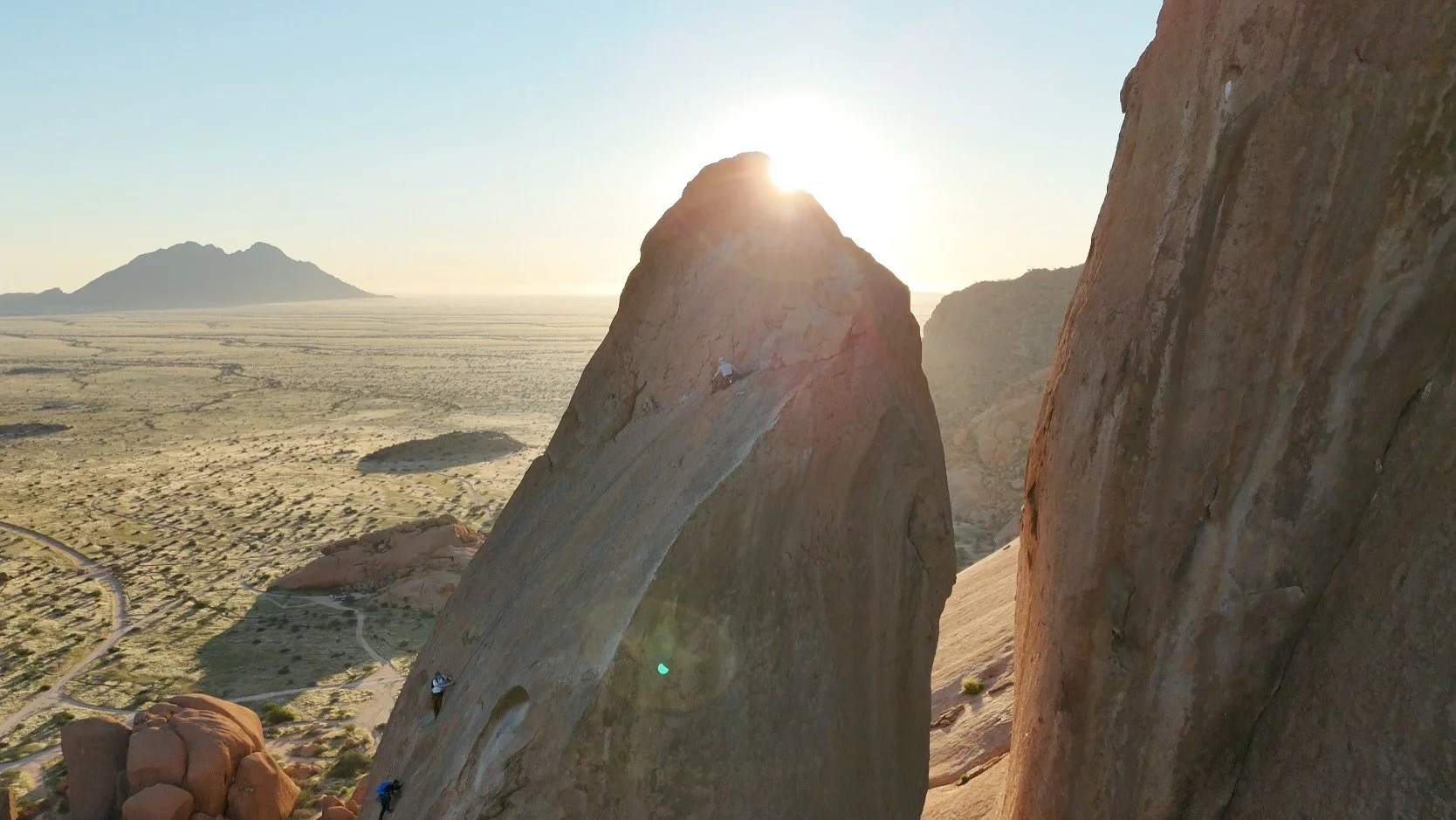
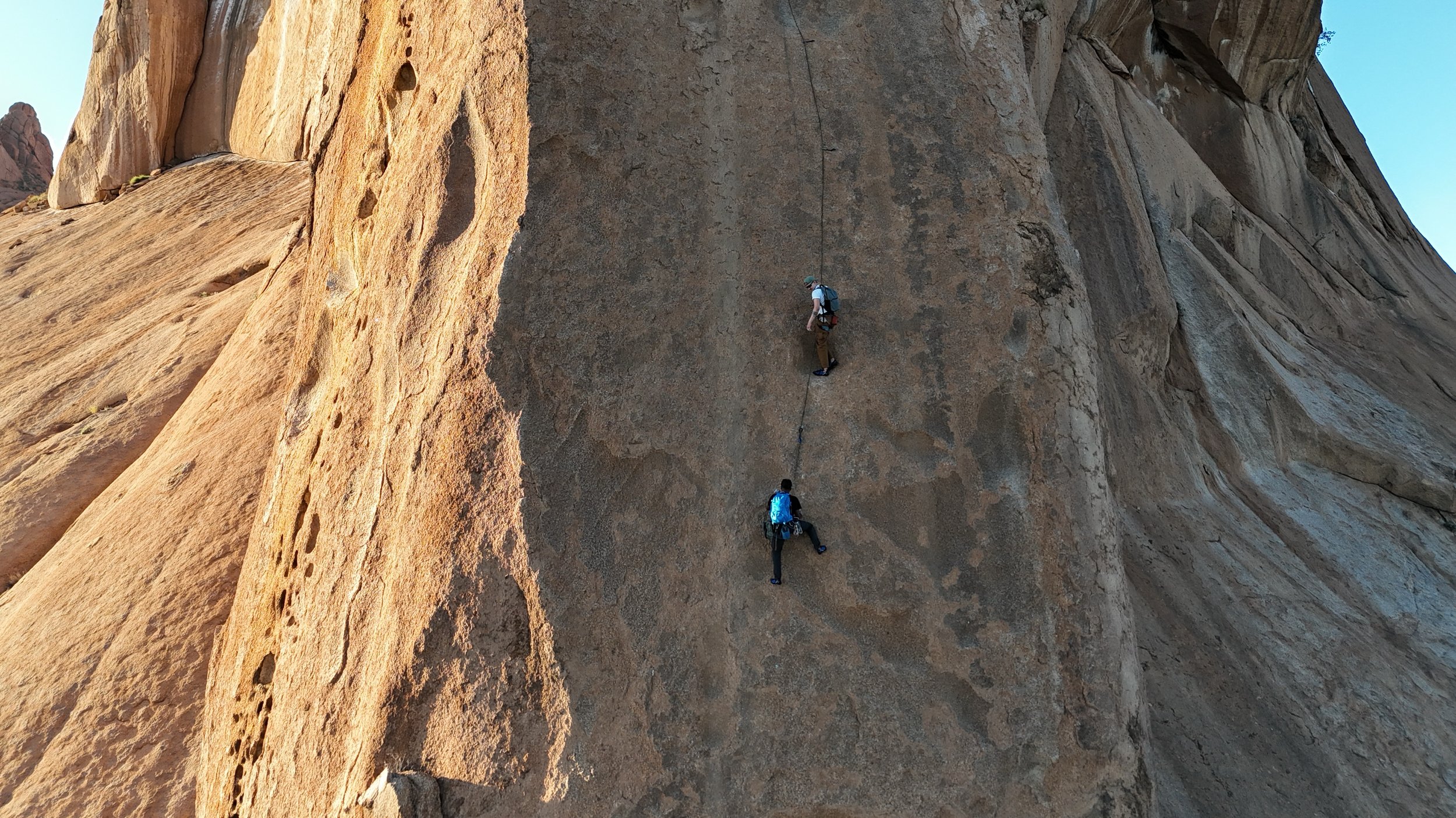
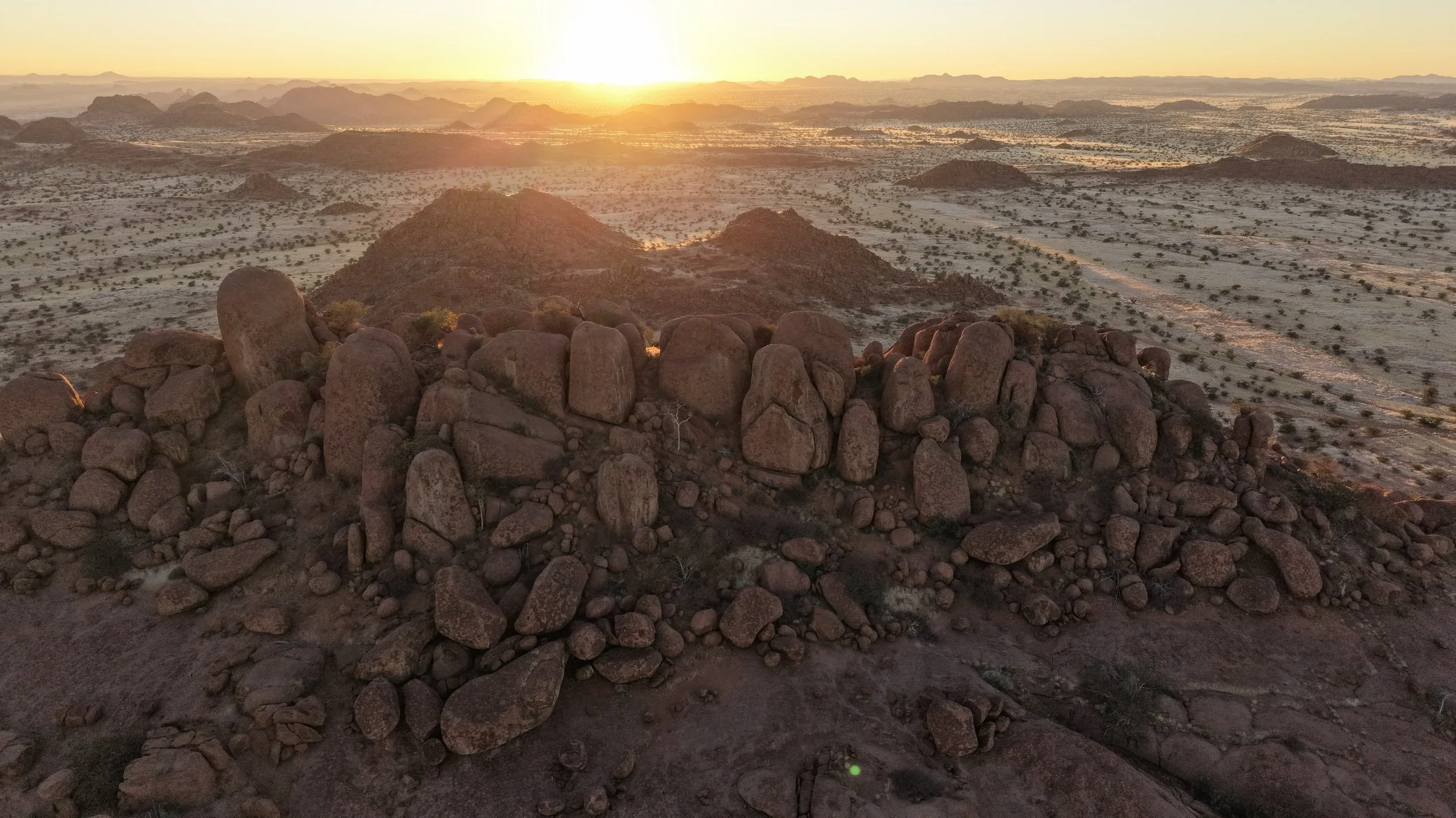
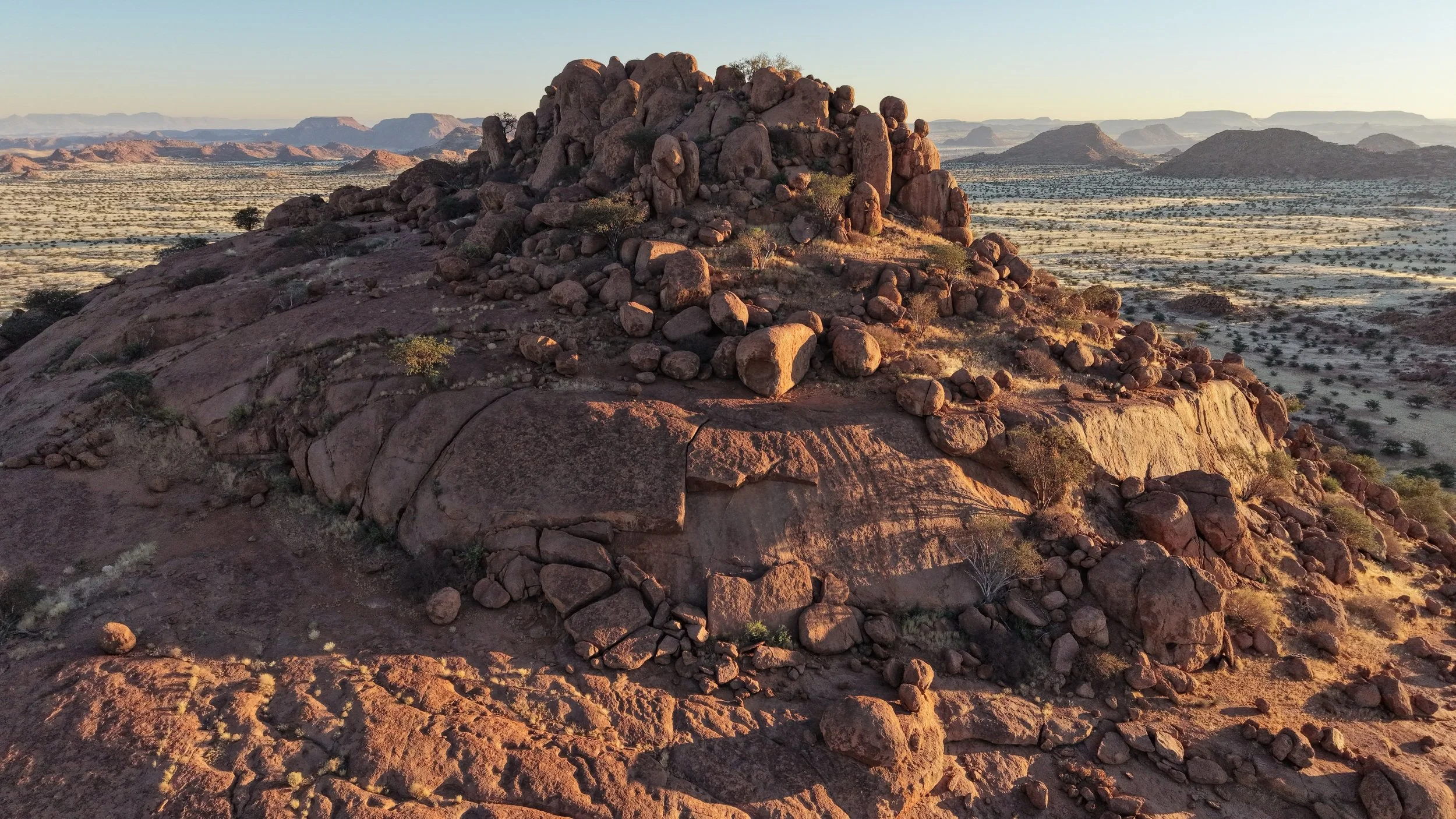
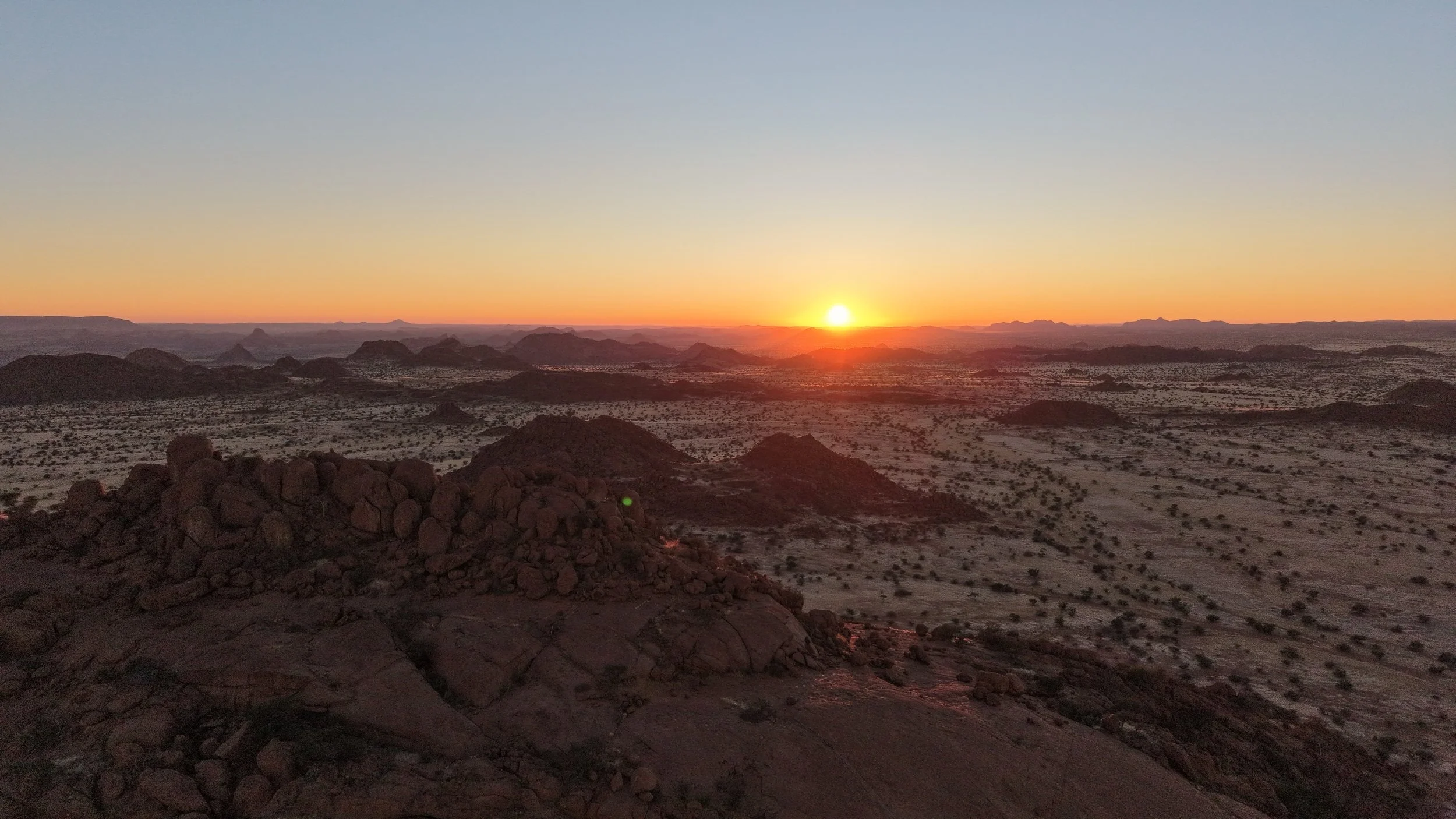
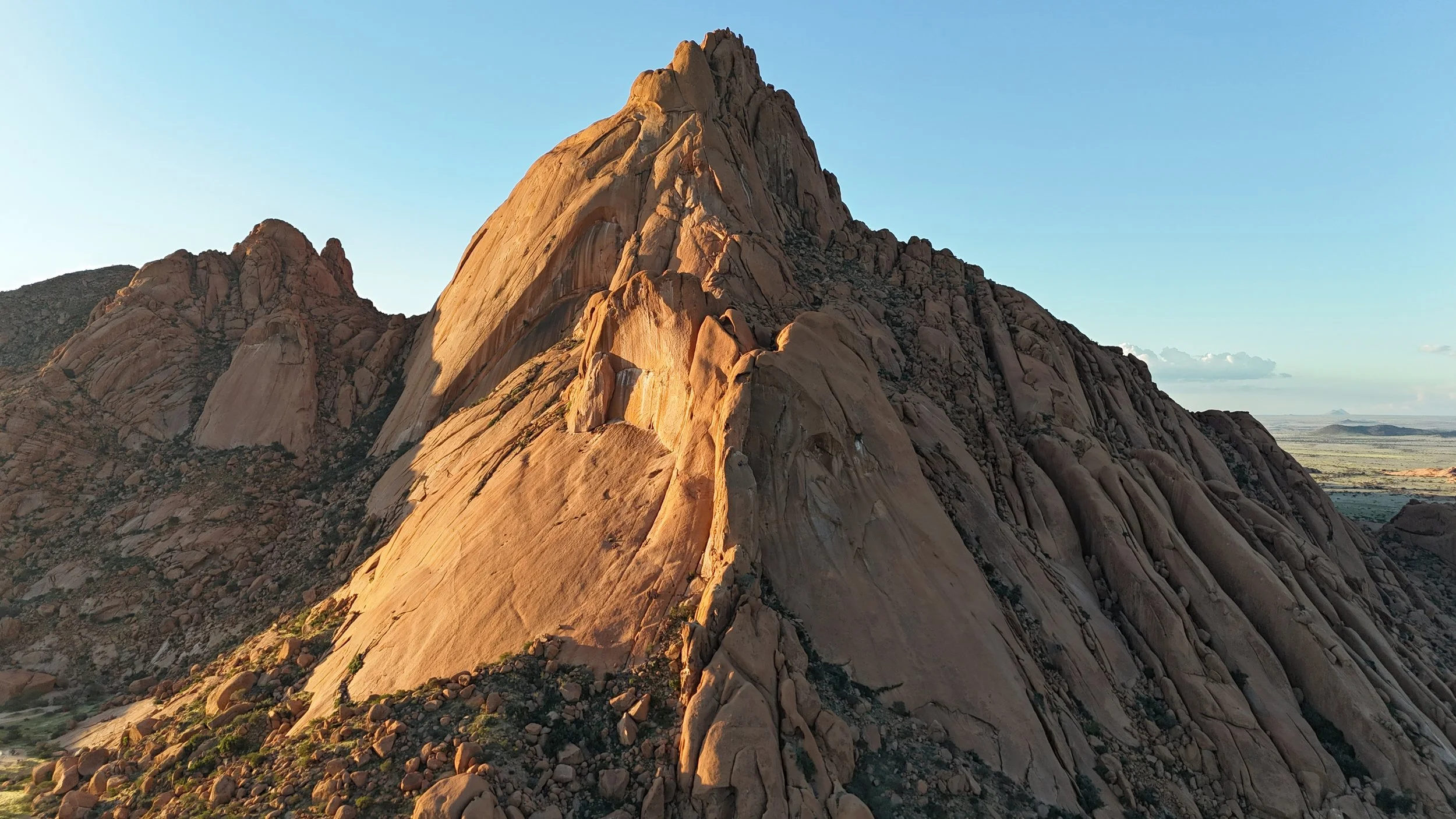
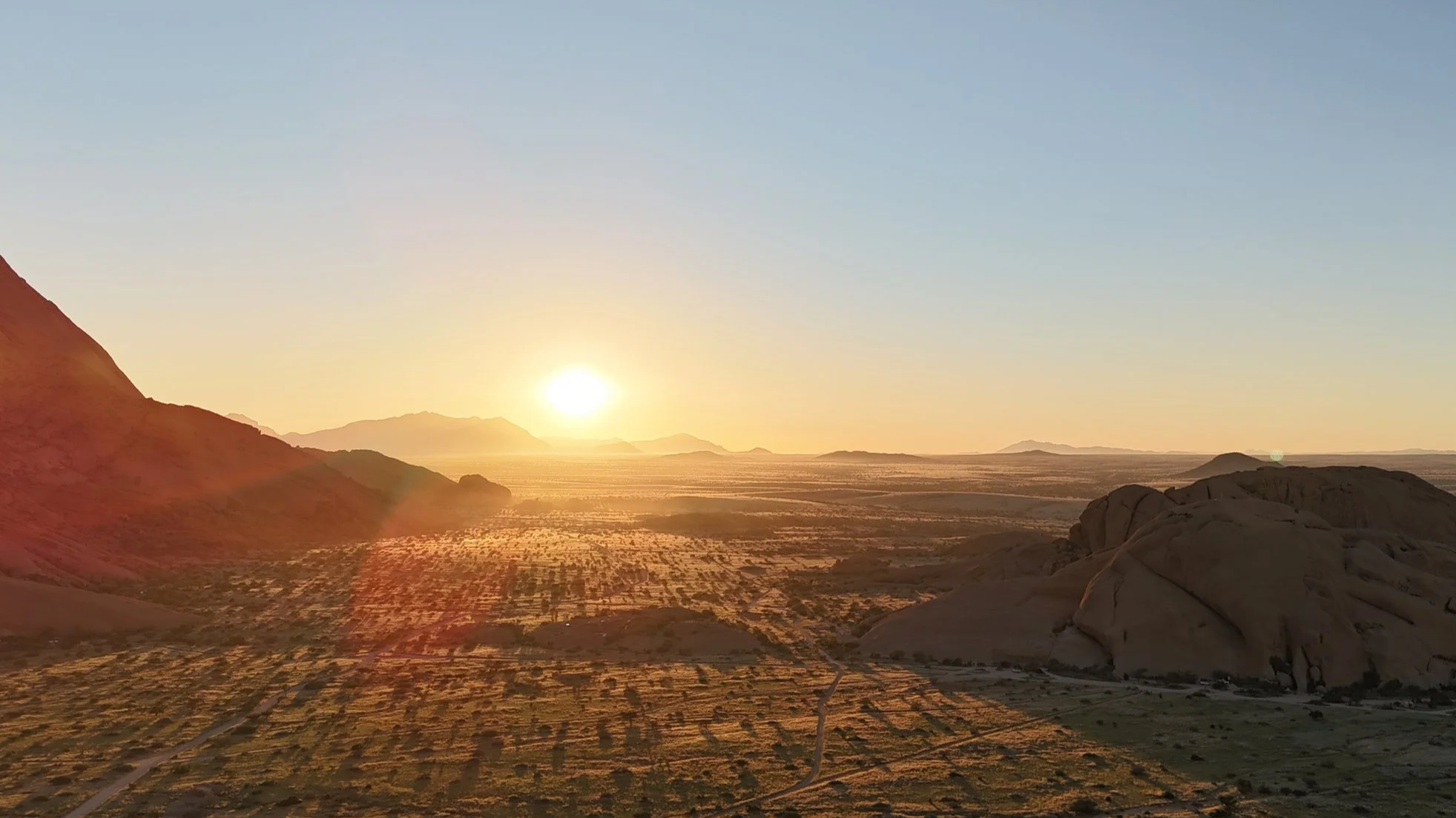
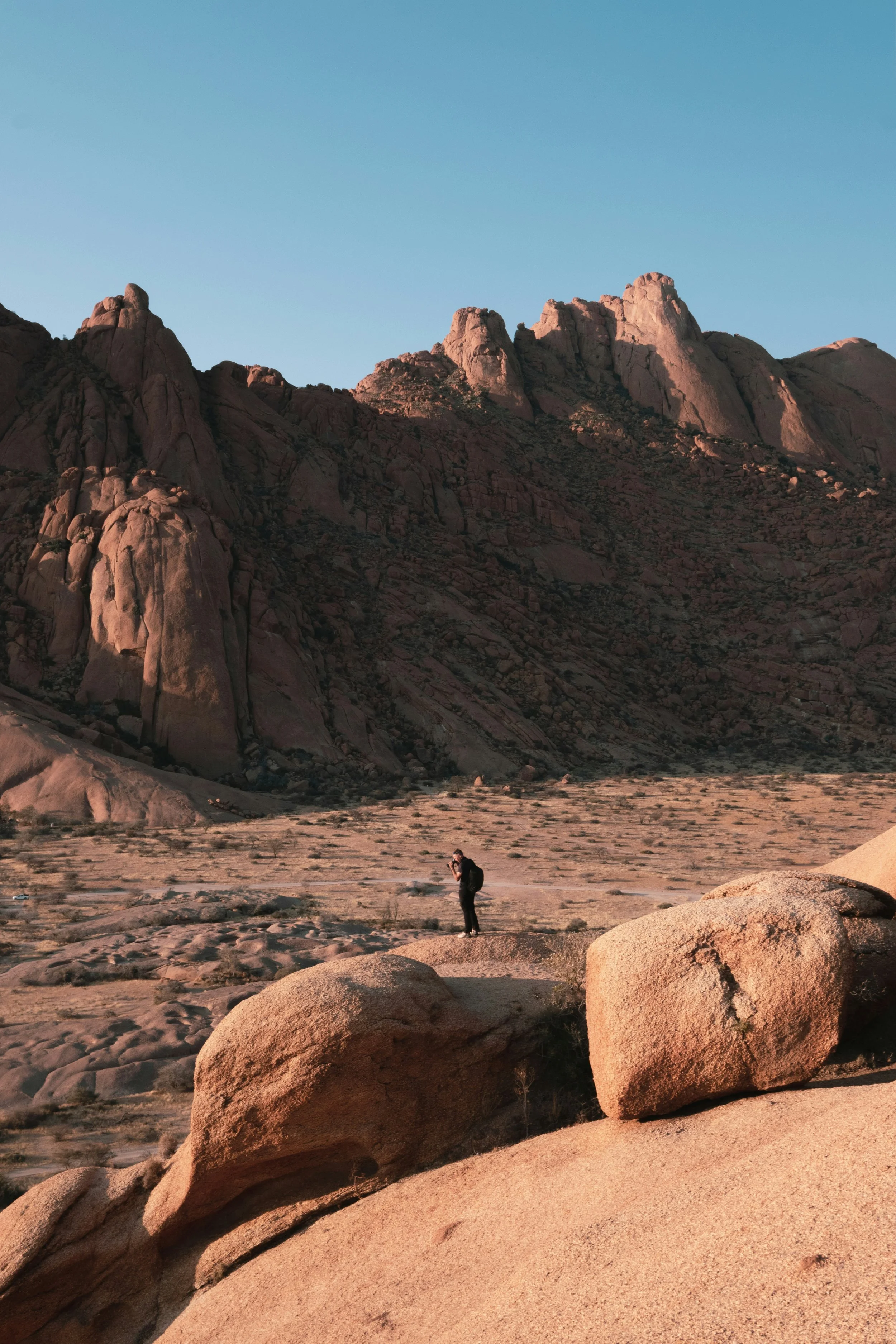
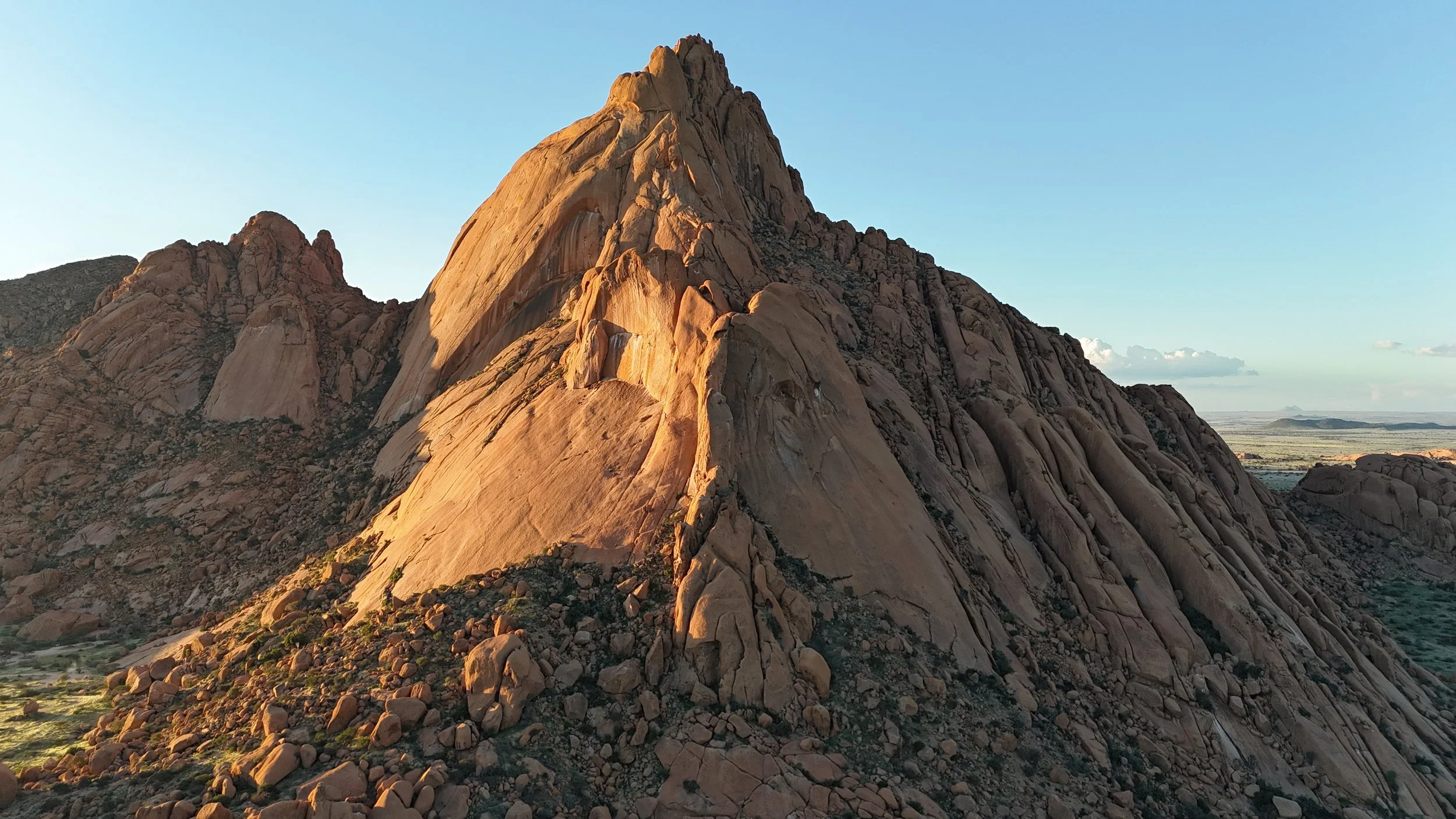
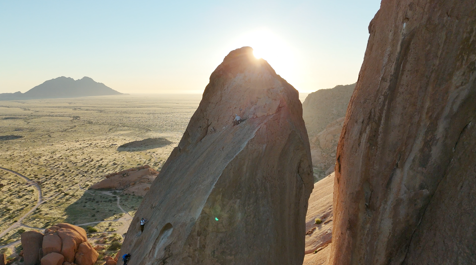
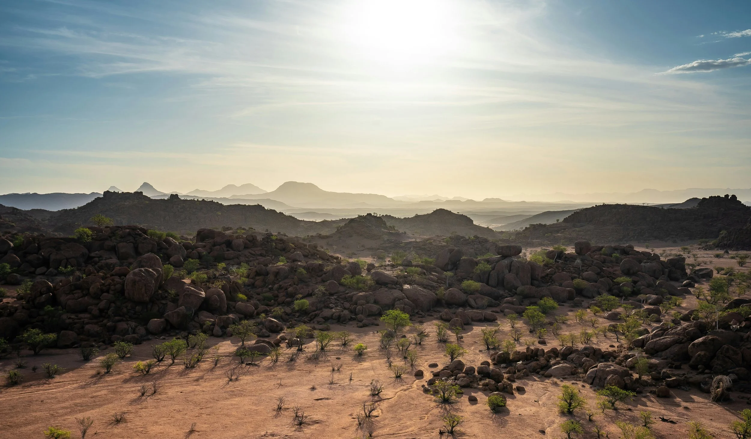
Case Study | Spitzkoppe Aerial Photography
Desert Drones Namibia conducted an aerial photography mission at Spitzkoppe, one of Namibia’s most recognizable mountain formations. The objective was to capture the scale, texture, and dramatic character of the granite peaks from a range of aerial perspectives.
The project documented key climbing areas, surrounding desert landscapes, and the relationship between the mountains and the wider Namib environment. The imagery highlights the geological significance and visual impact of the region while providing unique perspectives for tourism, marketing, and promotional use.
Services Provided:
Aerial Photography
Tourism Content
Landscape Documentation
Adventure Destination Marketing
-
![Close-up photograph of shallow water on a sandy beach, showing intricate water reflections on the sand beneath.]()
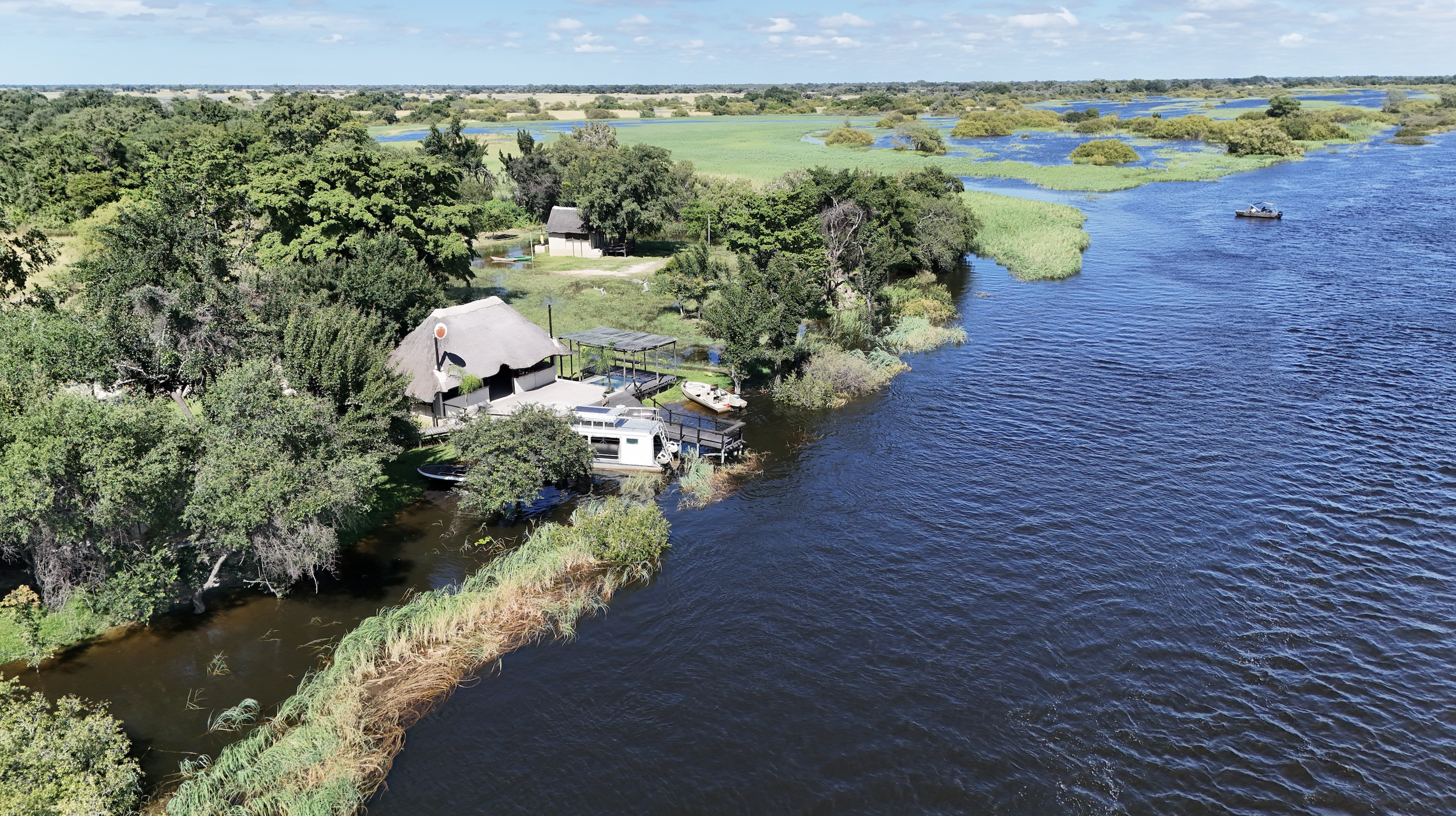
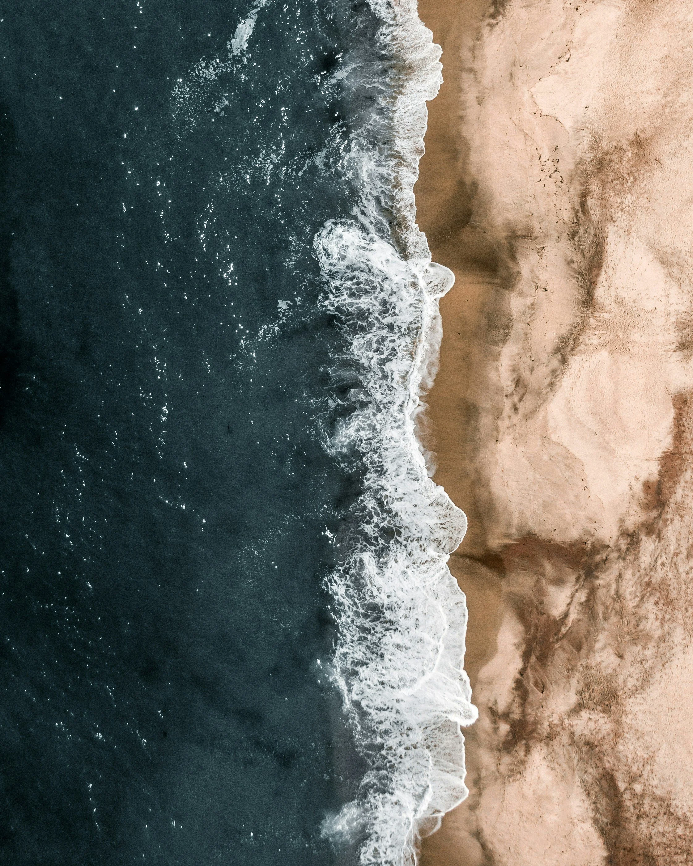
Case Study | Lodge on the Zambezi, Namibia
Desert Drones Namibia was engaged to capture aerial photography and video content for a riverside lodge located along the Zambezi River. The objective was to showcase the property’s unique setting, surrounding landscapes, and guest experience from perspectives impossible to achieve from the ground.
Using a combination of low-altitude cinematic flights and wide establishing shots, we documented the lodge’s relationship to the river, nearby wildlife habitats, and surrounding natural environment. The resulting imagery was created for use across websites, social media platforms, marketing campaigns, and tourism publications.
Services Provided:
Aerial Photography
Aerial Videography
Tourism Marketing Content
Property Documentation
Social Media Assets
-
![Modern backyard with a swimming pool, several lounge chairs, green lawn, desert plants, trees, and a house with a covered patio and outdoor furniture.]()
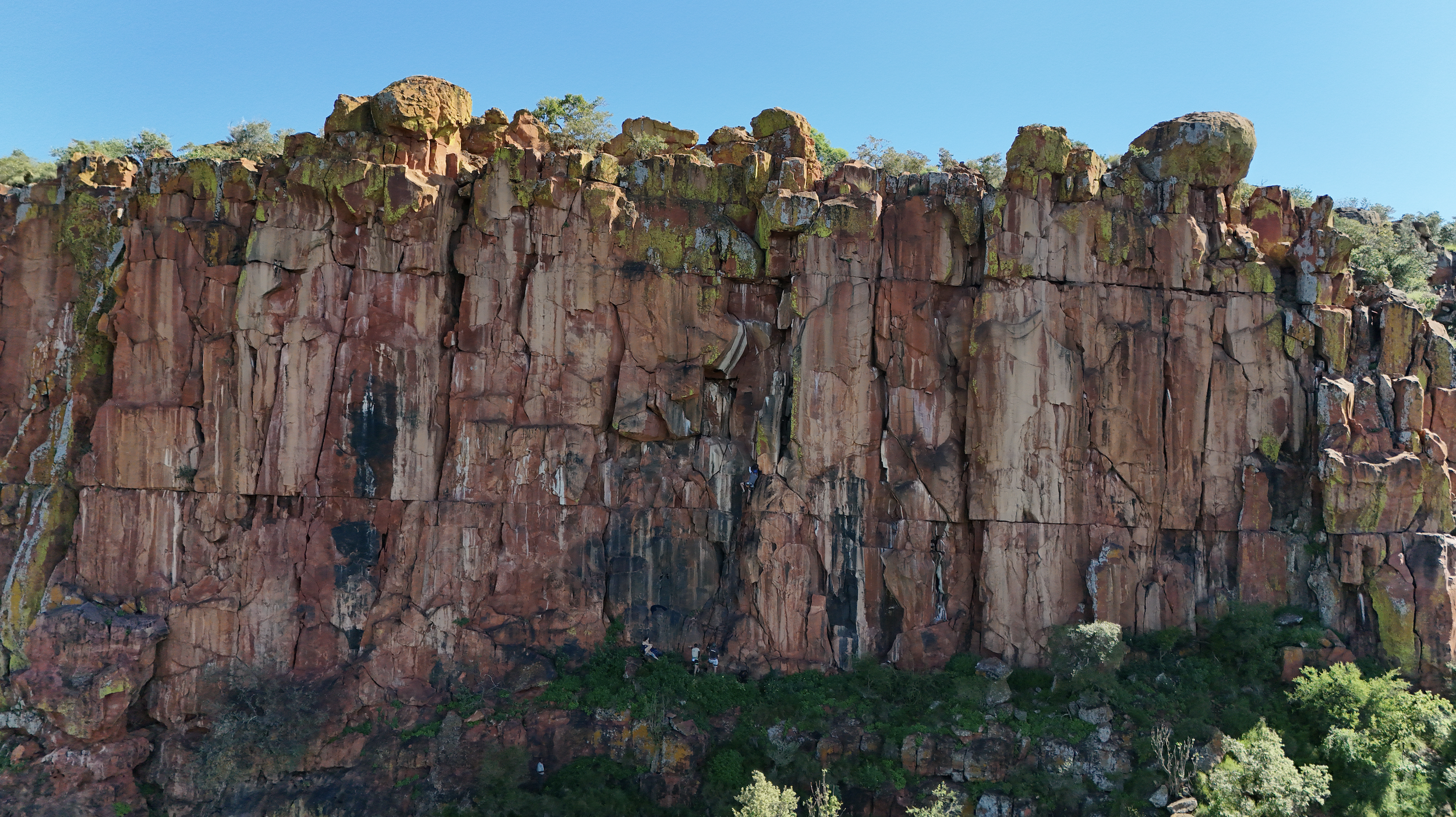
Case Study | Waterberg Aerial Photography
This aerial photography project focused on capturing the dramatic landscapes and geological formations of the Waterberg region. The goal was to create a collection of high-resolution imagery highlighting the area’s unique topography, natural beauty, and expansive wilderness.
Flights were conducted during optimal lighting conditions to emphasize the plateau’s distinctive cliffs, vegetation, and surrounding savannah landscapes. The resulting imagery provides a compelling perspective of one of Namibia’s most iconic natural landmarks.
Services Provided:
Aerial Photography
Landscape Documentation
Tourism Content Creation
High-Resolution Image Capture
-
![A field of daisy flowers with white petals and yellow centers, some in bloom and some budding, bathed in warm, golden light.]()
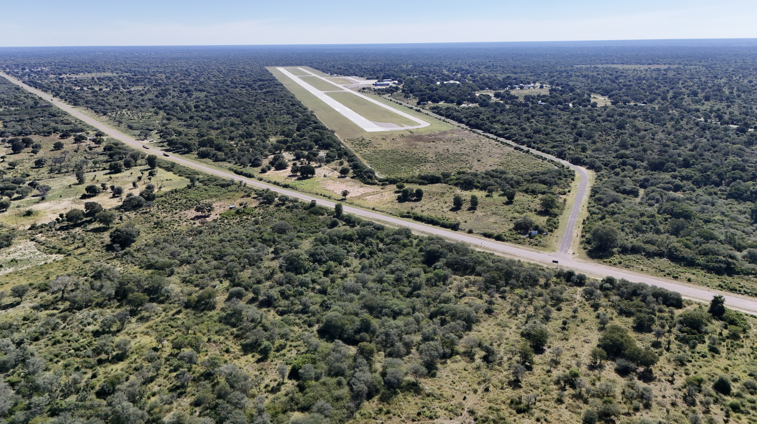
Case Study | Zambezi Airport Land Survey
Desert Drones Namibia completed an aerial survey and mapping exercise for land surrounding Zambezi Airport. The project involved capturing high-resolution aerial imagery to support planning, site evaluation, and future development considerations.
Drone flights provided a detailed overview of existing site conditions, surrounding infrastructure, access routes, and land use patterns. The resulting imagery and mapping data offered stakeholders a comprehensive visual understanding of the site while significantly reducing the time required compared to traditional ground-based documentation methods.
Services Provided:
Drone Mapping
Aerial Surveying
Site Documentation
Land Development Support
Infrastructure Assessment
Get in Touch